Africa
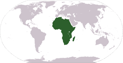 Africa is the world's second-largest and second most-populous continent, after Asia. At about 30,221,532 km² (11,668,545 mi²) including adjacent islands, it covers 6.0% of the Earth's total surface area, and 20.4% of the total land area. With more than 890,000,000 people (as of 2005) in 61 territories, it accounts for about 14% of the world's human population.
The continent is surrounded by the Mediterranean Sea to the north, the Suez Canal and the Red Sea to the northeast, the Indian Ocean to the southeast, and the Atlantic Ocean to the west.
Africa straddles the equator and encompasses numerous climate areas; it is the only continent to stretch from the northern temperate to southern temperate zones. Because of the lack of natural regular precipitation and irrigation, as well as virtually no glaciers or mountain aquifer systems there is no natural moderating effect on the climate except near the coasts.
Although European speculation about the nature of Africa south of Sahara (Aethiopia) dates back more than two millennia, Africa is generally assumed to be the continent longest inhabited by human beings.
Geography
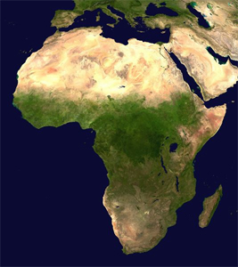 Africa is a continent comprised of 61 political territories (including 53 countries), representing the largest of the three great southward projections from the main mass of Earth's surface. It includes, within its remarkably regular outline, an area of 30,368,609 km² (11,725,385 mi²), including adjacent islands.
Separated from Europe by the Mediterranean Sea and from much of Asia by the Red Sea, Africa is joined to Asia at its northeast extremity by the Isthmus of Suez (which is transected by the Suez Canal), 130 km (80 miles) wide. For geopolitical purposes, the Sinai Peninsula of Egypt – east of the Suez Canal – is often considered part of Africa. From the most northerly point, Ras ben Sakka in Tunisia, in 37°21′ N, to the most southerly point, Cape Agulhas in South Africa, 34°51′15″ S, is a distance approximately of 8,000 km (5,000 miles); from Cape Verde, 17°33′22″ W, the westernmost point, to Ras Hafun in Somalia, 51°27′52″ E, the most easterly projection, is a distance (also approximately) of 7,400 km (4,600 miles). The length of coast-line is 26,000 km (16,100 miles) and the absence of deep indentations of the shore is shown by the fact that Europe, which covers only 10,400,000 km² (4,010,000 square miles), has a coastline of 32,000 km (19,800 miles).
The main structural lines of the continent show both the east-to-west direction characteristic, at least in the eastern hemisphere, of the more northern parts of the world, and the north-to-south direction seen in the southern peninsulas. Africa is thus composed of two segments at right angles, the northern running from east to west, the southern from north to south, the subordinate lines corresponding in the main to these two directions.
The average elevation of the continent approximates closely to 600 m (2,000 ft) above sea level, roughly near to the mean elevation of both North and South America, but considerably less than that of Asia, 950 m (3,117 ft). In contrast with other continents, it is marked by the comparatively small area of either very high or very low ground, lands under 180 m (600 ft) occupying an unusually small part of the surface; while not only are the highest elevations inferior to those of Asia or South America, but the area of land over 3,000 m (10,000 ft) is also quite insignificant, being represented almost entirely by individual peaks and mountain ranges. Moderately elevated tablelands are thus the characteristic feature of the continent, though the surface of these is broken by higher peaks and ridges. (So prevalent are these isolated peaks and ridges that a specialised term [Inselberg-landschaft] has been adopted in Germany to describe this kind of country, thought to be in great part the result of wind action.)
As a general rule, the higher tablelands lie to the east and south, while a progressive diminution in altitude towards the west and north is observable. Apart from the lowlands and the Atlas mountain range, the continent may be divided into two regions of higher and lower plateaus, the dividing line (somewhat concave to the north-west) running from the middle of the Red Sea to about 6 deg. S. on the west coast.
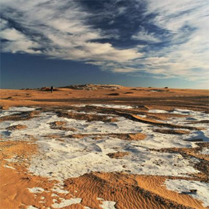
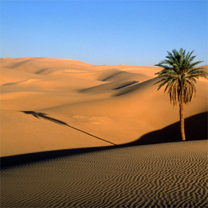
Africa can be divided into a number of geographic zones; The coastal plains - often fringed seawards by mangrove swamps - never stretching far from the coast, apart from the lower courses of streams. Recent alluvial flats are found chiefly in the delta of the more important rivers. Elsewhere, the coastal lowlands merely form the lowest steps of the system of terraces that constitutes the ascent to the inner plateaus, and the Atlas range — orographically distinct from the rest of the continent, being unconnected with and separated from the south by a depressed and desert area (the Sahara).
With one exception - Madagascar - the African islands are small. Madagascar, with an area of 229,820 square miles (595,230 km²), is, after Greenland, New Guinea and Borneo, the fourth largest island on the Earth. It lies off the S.E. coast of the continent, from which it is separated by the deep Mozambique channel, 250 miles (400 km) wide at its narrowest point. Madagascar in its general structure, as in flora and fauna, forms a connecting link between Africa and southern Asia. East of Madagascar are the small islands of Mauritius and Réunion. Socotra lies E.N.E. of Cape Guardafui. Off the north-west coast are the Canary and Cape Verde archipelagoes. which, like some small islands in the Gulf of Guinea, are of volcanic origin.
-wikipedia.org
Oceans | Home | Antarctica